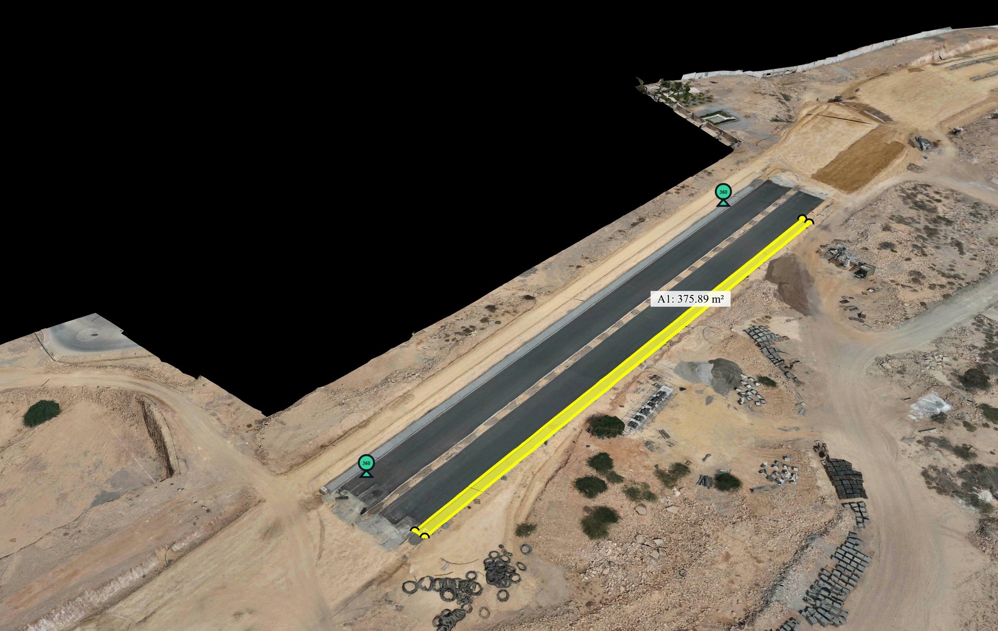
Measure it from your desk.
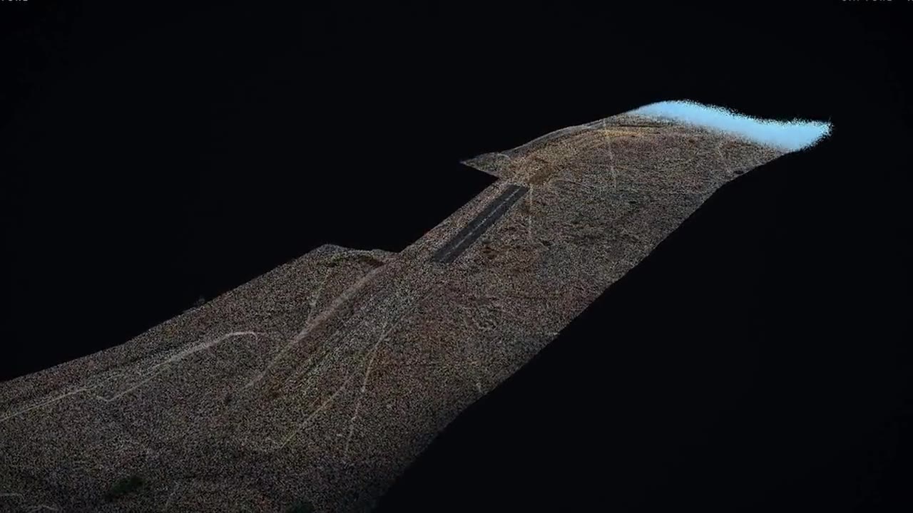
Rotate and zoom the 3D model for a virtual walk of the site, then measure distances, areas, heights and coordinates. Bookmark views and switch between the aerial map and 3D.
We fly your sites on an agreed schedule and publish every capture as dated maps and measurable 3D models.
Owners, consultants, contractors and lenders look at the same model with the same capture date on it, so progress reviews start from evidence instead of competing reports.
Every project in one place, with dated imagery, 3D models and actual against planned progress for each.
Measurable 3D models, same-angle comparisons, and notes pinned to exact locations on site.
A dated record of the work in place, reviewed by every party from the same source.
Dated visuals and plain progress figures for periodic reports and board packs.
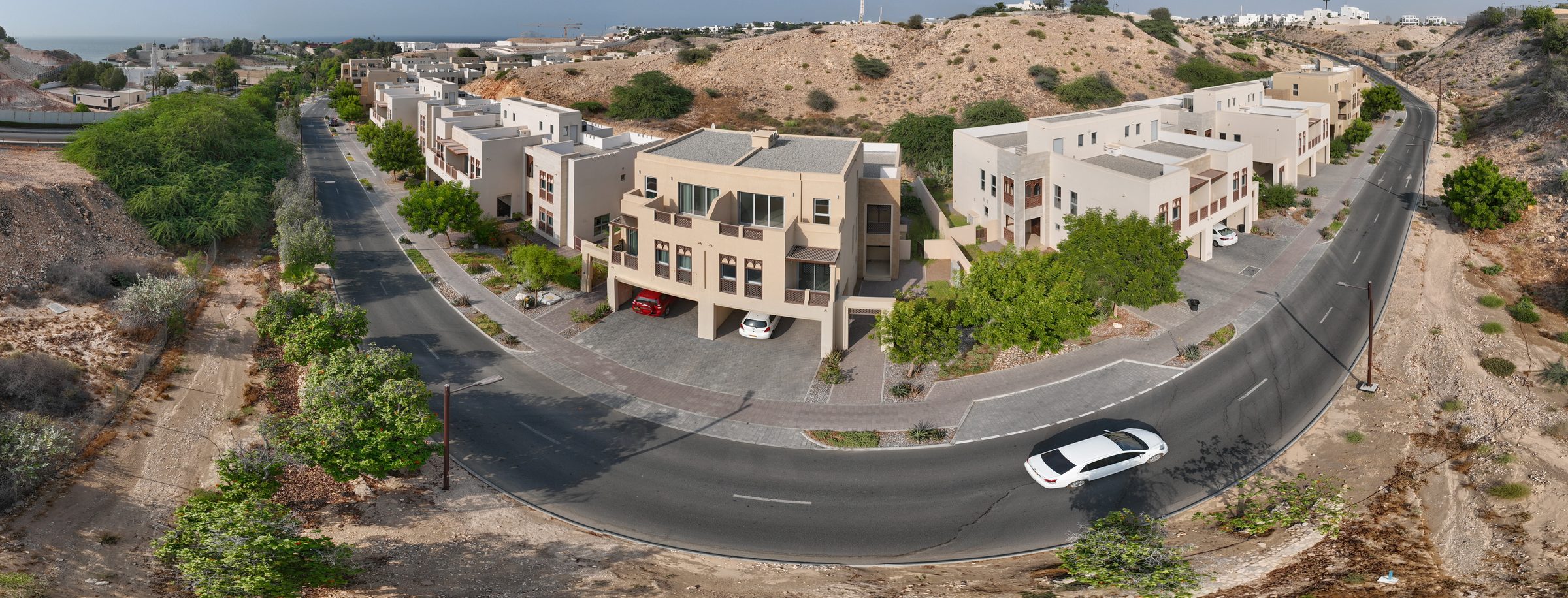
The same site, flown again every month. Each capture keeps its date, measures to within 3 cm and stays on the platform, so any two dates can be compared.
Each project on the platform shows its latest capture date, and updates with every new flight.
Rotate and zoom the 3D model for a virtual walk of the site, then measure distances, areas, heights and coordinates. Bookmark views and switch between the aerial map and 3D.
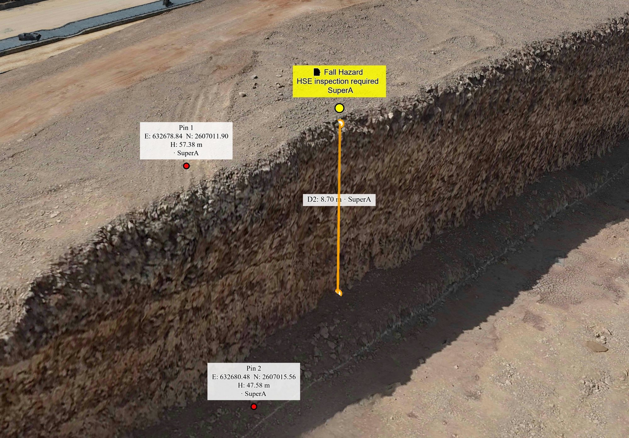
Pins and notes sit on exact locations. A missing edge protection is raised on the model, with its date and position, instead of being described in an email chain.
Two captures of the site from the same angle, February and July 2026, with a slider that reveals what changed. Progress is easy to read and differences are easy to question.
On the platform
Files on request
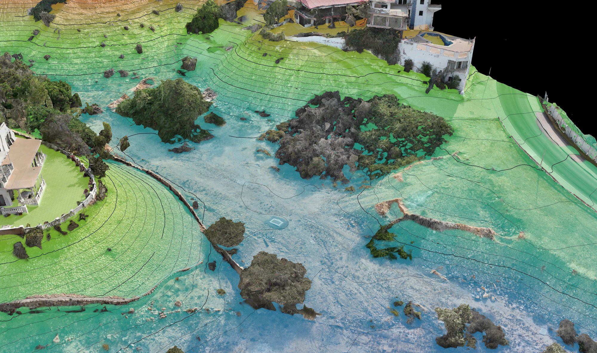
The site’s captured contours with the design’s BIM model placed on real ground, so levels are settled early. Monthly terrain models become cut and fill volumes, and any stockpile can be measured from the model.
Volumetric outputs support monitoring and verification. They complement, and do not replace, certified surveys.
How much you save depends on how many projects you run, how far apart they are and how often they are flown. The time comes back in three places.
Fewer trips to distant sites made only to check progress.
Less time collecting photos and reports from several parties.
Deviations spotted before they turn into costlier rework.
A 30-minute walk-through of the platform with your team, then a pilot on one of your projects, with the results reviewed together.
A 30-minute walk-through of the platform and your needs.
Agree the scope and the capture frequency.
Permits, flights and data processing, handled by Reflyction.
Platform access and a results review with your team.
Earthworks are measured against the ground as it was before excavation, and once excavation starts that surface is gone. A first capture before works records it as the reference for the life of the project.
We mobilise within 48 to 72 hours of contract signing. We hold drone operation permits, but site permits usually take 2 to 4 weeks, so the first update is typically live 2 to 4 weeks after contract.
±3 cm horizontal and ±5 cm vertical absolute accuracy, from RTK-corrected flights and surveyed ground control points.
Everything is on the browser-based platform, with no software to install. We also export LAS and LAZ point clouds, OBJ models, GeoTIFF orthomosaics and PDF reports.
On cloud infrastructure, with access limited to authorised users who each see only what their permissions allow. Data is encrypted in transit.
Yes. Every project sits in one portfolio view, each with its own team access and its own capture schedule.
By project size and capture frequency. Annual platform subscriptions include dashboard access and a dedicated account manager, and developers with five or more active sites can agree custom terms. Ask us for a proposal.
نصوّر مواقعكم جوًّا وفق جدول متفق عليه، وننشر كل تصوير على هيئة خرائط مؤرّخة ونماذج ثلاثية الأبعاد قابلة للقياس.
يطّلع الملّاك والاستشاريون والمقاولون والجهات المموّلة على النموذج نفسه وبتاريخ التصوير نفسه، فتبدأ مراجعات الإنجاز من الدليل، لا من تقارير متعارضة.
جميع مشاريعكم في مكان واحد، ولكلٍّ منها صور مؤرّخة ونماذج ثلاثية الأبعاد، ونسبة الإنجاز الفعلية مقابل المخطط.
نماذج ثلاثية الأبعاد قابلة للقياس، ومقارنات من الزاوية نفسها، وملاحظات مثبّتة على النقطة المعنية بالضبط.
سجلّ مؤرّخ للأعمال المنفّذة، يراجعه جميع الأطراف من المصدر نفسه.
صور مؤرّخة وأرقام إنجاز واضحة للتقارير الدورية وعروض مجالس الإدارة.
أعمال الطريق نفسها، تُصوَّر جوًّا كل شهر. يحتفظ كل تصوير بتاريخه، ويُقاس بدقة تصل إلى 3 سم، ويبقى محفوظًا على المنصة للمقارنة بين أي تاريخين.
يظهر كل مشروع على المنصة بتاريخ آخر تصوير له، ويُحدَّث مع كل رحلة جديدة.
دوّر النموذج ثلاثي الأبعاد وكبّره لتتجوّل في الموقع افتراضيًا، ثم قِس المسافات والمساحات والارتفاعات والإحداثيات. احفظ زوايا العرض، وانتقل بين الخريطة الجوية والعرض ثلاثي الأبعاد.
تُثبَّت الدبابيس والملاحظات على مواقعها الدقيقة. فغياب حماية الحافة يُسجَّل على النموذج بتاريخه وموقعه، بدل أن يُشرح في سلسلة رسائل بريد إلكتروني.
تصويران للموقع من الزاوية نفسها في فبراير ويوليو 2026، مع شريط تمرير يكشف ما تغيّر. التقدّم واضح للقراءة، وأي اختلاف واضح للمساءلة.
على المنصة
ملفات عند الطلب
خطوط الكنتور الفعلية للموقع، ونموذج BIM للتصميم موضوع على الأرض كما هي، لتُحسم المناسيب مبكرًا. وتتحوّل نماذج التضاريس الشهرية إلى كميات حفر وردم، ويمكن قياس أي كومة مواد من النموذج مباشرةً.
مخرجات الكميات تدعم المتابعة والتحقق، وهي مكمّلة للمسوحات المعتمدة ولا تحلّ محلها.
يعتمد حجم التوفير على عدد مشاريعكم، والمسافات بينها، وعدد مرات تصويرها. ويعود إليكم الوقت من ثلاثة مصادر.
رحلات أقل إلى مواقع بعيدة لمجرد التحقق من الإنجاز.
وقت أقل في جمع الصور والتقارير من أطراف متعددة.
رصد الانحرافات قبل أن تتحول إلى إعادة عمل أعلى كلفة.
جولة تعريفية بالمنصة مع فريقكم مدتها 30 دقيقة، ثم تجربة على أحد مشاريعكم، ومراجعة النتائج معًا.
جولة مدتها 30 دقيقة في المنصة وفي احتياجاتكم.
الاتفاق على النطاق وتكرار التصوير.
التصاريح والطيران ومعالجة البيانات، تتولاها Reflyction.
تفعيل الوصول إلى المنصة، ومراجعة النتائج مع فريقكم.
تُقاس الأعمال الترابية قياسًا إلى الأرض كما كانت قبل الحفر، ومتى بدأ الحفر زال ذلك السطح. التصوير الأول قبل بدء الأعمال يوثّقه مرجعًا طوال عمر المشروع.
نبدأ فترة التجهيز خلال 48 إلى 72 ساعة من توقيع العقد. لدينا تصاريح تشغيل الطائرات المسيّرة، لكن تصاريح الموقع تستغرق عادةً من أسبوعين إلى أربعة أسابيع، لذا يُنشر أول تحديث في الغالب بعد 2 إلى 4 أسابيع من التعاقد.
دقة مطلقة ±3 سم أفقيًا و±5 سم رأسيًا، من رحلات مصحّحة بتقنية RTK ونقاط تحكم أرضية مرفوعة مساحيًا.
كل شيء متاح على المنصة من المتصفح، دون تثبيت أي برنامج. ونصدّر كذلك سحب النقاط بصيغتَي LAS وLAZ، ونماذج OBJ، وخرائط أورثوموزاييك بصيغة GeoTIFF، وتقارير PDF.
على بنية سحابية، ويقتصر الوصول على المستخدمين المخوّلين، ولا يرى كلٌّ منهم إلا ما تسمح به صلاحياته. والبيانات مشفّرة أثناء النقل.
نعم. تظهر جميع المشاريع في عرض محفظة واحد، ولكل مشروع صلاحيات فريقه وجدول تصويره الخاص.
حسب حجم المشروع وتكرار التصوير. تشمل الاشتراكات السنوية في المنصة الوصول إلى لوحة المؤشرات ومدير حساب مخصصًا، ويمكن للمطوّرين الذين لديهم خمسة مواقع نشطة أو أكثر الاتفاق على شروط خاصة. اطلبوا منا عرض سعر.